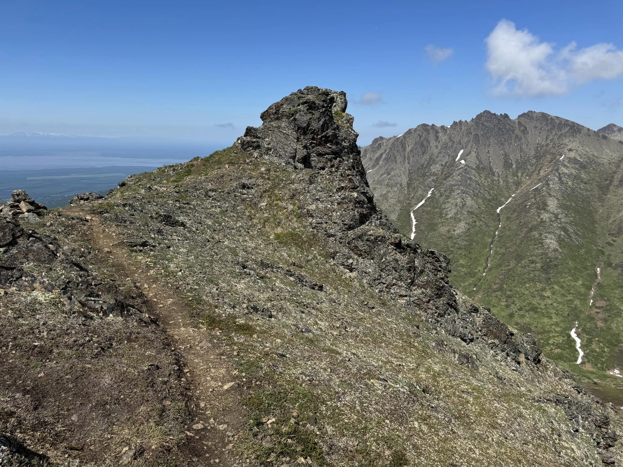
Today was another sunny perfect day for a nice climb in the mountains. My friends assured me this hike was not as hard as the Government Peak Loop on Saturday. But it was still a very challenging trek. The views of the surrounding mountains and Eagle River below are pretty spectacular. As usual, I started with Bella on her leash in case we encountered other dogs. But after awhile, I let her loose. She ran up and back, hopping over the rocky outcroppings and checking the hiker in front then running back to whoever happened to be bringing up the rear. For a nice change, that wasn't always me. The first part of the trail reminds me of the Blueberry Knoll Trail, very steep and mostly a collection of tree roots that almost form a long steep set of stairs. Once above treeline, we were on a nice ridge. But that ridge seemed to go on forever. It has many ups and downs, which were basically a series of little mountains. I kept wondering which pile of rocks in the far distance would turn out to be Mount Magnificent. We encountered a few patches of snow and did have to cross one. In a few places I broke through and buried my foot about one foot deep. But most of the way I managed to stay on top. Similar to Pepper Peak, we had to negotiate a series of steep rocky precipices that made us all a little nervous at times. There were some small muddy patches and areas where snowmelt was making things more slippery than in the dry season. I had to be careful not to trip over my trekking poles while using both hands to climb up the rocks. I kept worrying about Bella, but it really wasn't necessary. She negotiated the rocks as if she was casually walking on flat ground. She has the balance, energy, and agility of the average squirrel and was at the summit with the two hikers that got there first. It was so nice and warm, around 70 degrees but not as hot as our Saturday hike. We had a nice breeze the whole way up and down. Most of the ridge we had a view of the whole Eagle River Valley. We could see all the mountains of the Chugach Range that surrounded us. There isn't much room on the actual summit, but we managed to have a nice break up there and enjoy a snack. I was concerned that the trip back down might be treacherous since it was a little unnerving on the way up. But Judith and I started down first and easily got through the parts that were scary on the way up, with no trouble at all. Bella of course, bounced easily down all of it. By the time we got about halfway down, Bella was starting to look really tired. She started following right behind me instead of taking the lead all the way down. We both got a nice break when we took a few minutes to rest on some really soft tundra vegetation while the rest of the group caught up with us. Once down into the trees, I started to wonder how I had ever made it up the trail. It seemed so steep and so much longer than I had remembered. I guess we were all very tired. The whole trip was 7 miles and we took about 6 hours. I'm glad I got to do this beautiful hike, and especially since I was with others who had done it before. It was another place where it was difficult to determine exactly where the summit is. There are so many false summits along the way.
 |
| Clouds rolling in while we were on the summit |
 |
| Look closely to see 3 of our group descending from the summit. |
 |
| Eagle River down below |


No comments:
Post a Comment