Friday, October 13, 2023

Matanuska Lakes Trails

Hiked our familiar Matanuska Lake Trails with Pam today. We mostly walked the typical Long Lake Loop but decided to check out some unknown trails that we encountered. It's amazing how many trails there are meandering around in the Matanuska Lake/Crevasse Moraine area. We found several trails that neither of us had walked before. There was a lot of fog in the valley but we were mostly out of it on this hike. But in places we could see fog lying on the lakes, which always makes the view a bit more interesting. Most of the leaves are now on the ground, but we still found a few colorful remaining signs of autumn. Instead of our usual 4 miles we hiked over 6 1/2 miles. It was pretty and pleasant as always.


Monday, October 9, 2023

Lazy Mountain Trail Marking

 I hiked the back of Lazy Mountain with the Valley Wanderers today. First we hiked up the McRoberts Creek Trail then turned up to the area we call Stonehedge at about 2000 feet. We were totally in a heavy fog until we finally broke out of the clouds at Stonehenge. It was cold, only about 35 degrees and I never needed to take off any layers. It was also pretty muddy and I put my microspikes on my shoes to negotiate the muddy hills. The mud and fallen leaves were building up quite a bit on the bottom of my shoes, so at times it was just as slippery even with the spikes. I only toppled over backwards once. When we got to Stonehenge, we suddenly boke out of the fog and had an amazing view of the mountains with a sea of clouds below. The sun felt delightful after shivering for 2000 feet of elevation gain. We had a project to do so didn't try to reach the Lazy Mountain summit. Our goal was to flag the little unofficial trail that takes off from Stonehenge and connects with the Matanuska Peak Trail. When we climbed Lazy Mountain last week, we tried to go down that trail but ended up missing a turn and had to bushwack down to the main trail. So today we marked it so that in the winter we will be able to find it when we snowshoe there on the snow. We'll have to come back soon and see if we can still find our way using our flags. It was only about 4 miles, but it was a great workout and we all loved the view from Stonehenge.


Saturday, October 7, 2023

Red Shirt Lake Trail

 Hiked the Red Shirt Lake Trail today with the Valley Wanderers. Pam also joined us. It was a new trail for most of the group but one I have done several times. It's a lot like the Crevasse Moraine Trails, heavily wooded with narrow pathways up and down gentle hills. There is not much elevation gain because we basically cross a ridge then descend down to the lake.  It's 6 miles round trip. The trail was very wet with many muddy sections. It also has a lot of tree roots, which were extremely slippery because they were wet and covered with wet leaves. I slipped and landed on one knee at one point, but that was the only fall in the group. I just got mud on my pants but that's all. Most of the leaves have fallen, making the trail itself golden but the trees bare. There was an occasional golden tree. The first half of the trail was very foggy, giving it a mysterious feeling. Shortly before we reached the lake, the fog lifted and we had a nice sunny walk. The lake is beautiful and it was totally calm. They do rent canoes there and it would have been a perfect day to be out on the water. But you need to arrange to rent the boats before you leave the trailhead. There are quite a few canoes there at the end of the trail on the shore of the lake. I'd love to bring my kayak in there, but that's a longer walk that I want to do, carrying my boat, even if it is pretty light. 


Friday, October 6, 2023

Crevasse Moraine Hike

 Took a nice 6 mile hike with Pam and Dahla today. It's really cold and the weather is questionable. So we didn't want to take on anything too serious. We checked out the Moose Mesa Trail and followed the branch that we couldn't find earlier over the snow. We discovered a very nice little winding single track trail. Last winter that trail was so snow-covered that we weren't able to follow it. After that we just followed the trails that we knew best back to the trailhead. The autumn leaves are mostly all gone in that area, which was a little disappointing. The only pictures I took were right back at the trailhead. But it was still a very pleasant hike and good exercise.


Wednesday, October 4, 2023

Spring Creek Explore

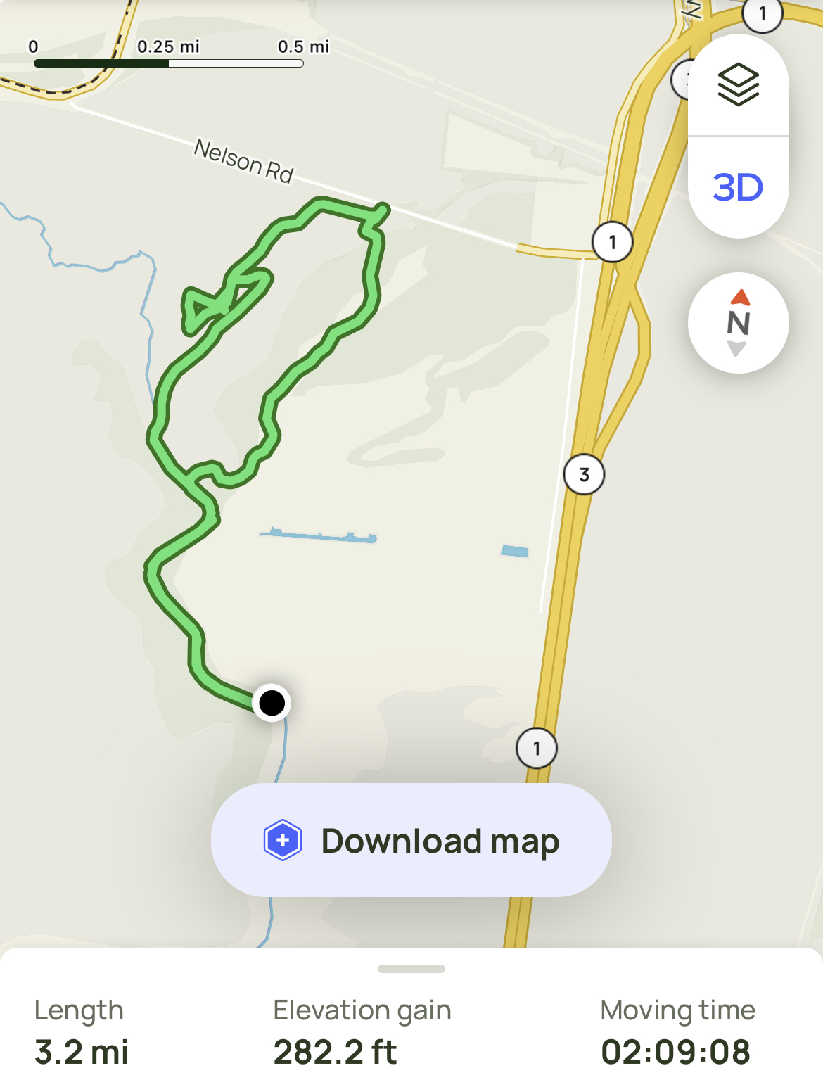
 I love wandering around in swampy areas in my kayak. A favorite place is the Rabbit Slough/Palmer Slough area. On the map I could see that there is an official creek that runs from close to the Matanuska River, under the Glenn Highway, across Nelson Road and then splits into two forks, both emptying into Palmer Slough. I have tried to paddle up Spring Creek from both junctions but was never able to make it all the way to Nelson Road. The last time I tried, I got lost amid the swamp vegetation. Then I drove up Nelson Road and discovered it was closed where the creek crosses, because the culvert is collapsed. Today I thought I'd give it another try and see if I could actually navigate Spring Creek. The water is much higher now, and fortunately it was very calm. I put my kayak in at the boat ramp and paddled upstream until I reached the first fork of Spring Creek. I found I was easily able to locate the channel until close to Nelson Road, but after a few small detours, I got back in the channel and went right to the crushed culvert. From there I turned around and paddled a very short distance to the fork that branches away from the main one. It was a little more difficult to stay in this channel because the water was so high. At times the channel seemed to disappear and I wondered if the water was so high that I could just go straight back to Palmer Slough. I wandered for a bit trying to do that, but ended up in thick reeds and grasses. I knew I needed to get back to the main channel before I got too stuck to move! I simply backtracked and also used the AllTrails app on my phone to be sure I was still headed towards Spring Creek. Once I reached the actual channel, it widened up and I easily floated back to Palmer Slough. It was very beautiful and quiet out there. I am so happy I finally was able to navigate both forks of Spring Creek. I may try to do it again this winter on my skis. I do appreciate the convenience of a GPS tracking app that helps me know exactly where I am. I think a person could wander out there in the swamp for a long time without that advantage. It's a nice place to lose yourself though.

My Route on AllTrails


Tuesday, October 3, 2023

The Perch & Dew Mound Hike

 I took a lovely hike today with the Valley Wanderers on the Crow Pass Trail from the Eagle River Nature Center. We only planned to hike around 9 miles to a huge rock outcropping that everyone calls The Perch. There is also another rock mound along the way called Dew Mound, that we climbed to have a nice snack break. It was really chilly and the sun was hidden by the trees and mountains until we reached the river itself. I kept thinking I should add another layer of coat but kept putting it off, believing we should hit sunlight soon. I didn't really warm up until we reached the Perch, our final destination. There are still a lot of bright gold colors on the trees, but most of the leaves have already fallen on the majority of the trail. It made the trail very beautiful with a blanket of golden leaves. They also made it quite slippery causing a few of our group to slip and fall. I came close a couple of times but managed to stay upright for the entire 9 miles. The Perch has the most beautiful view of Eagle River and the surrounding mountains. I loved how the sun reflected off the water. We had a nice lunch break, finally warm in the sunshine on the rock overlooking the view. I've decided it's time to get out my winter coat and winter hiking boots, since my feet were cold the entire time. But it was worth it! A lovely day.


Saturday, September 30, 2023

Lazy Mountain Southside Trail

 I hiked today with the Valley Wanderers up the back side of Lazy Mountain. The fall colors are really getting beautiful back there. This route is a little longer than the regular Lazy Mountain Trail, but in many ways it is more scenic and interesting. There are actually several trails on this side of the mountain. We started up the McRoberts Creek Trail then took the steep cutoff up to the Matanuska Peak Trail. Then at the wooden tripod, we turned up towards Lazy Mountain through the rocky area we've nicknamed Stonehenge. So named due to piles of rock cairns people have placed there over the years. We had a snack and a short break then continued on up the steep hill to the summit. It was a little windy but not too bad. It was in the high 30's when I left home and likely about the same up there at 3700 feet. On top we had our official lunch, took our photos then started down intending to take the same route back. But at Stonehenge, there is another steep trail that takes a more direct route down to the Matanuska Peak Trail. We took that one. It was rather overgrown and difficult to follow at times. We managed to lose that trail and had an interesting diversion walk through brush and thick alders before finally being reunited with the official trail. I was tracking us with the AllTrails iPhone app and we used its GPS to point us in the right direction. It was very helpful. We had been walking parallel to the main trail and could see the direction we needed to go to get back on the trail. We had to fight the alders for a short distance but likely didn't go too far out of our way before we were back on the Matanuska Peak Trail. When we got to the steep connector that goes down to the McRoberts Creek Trail we decided to just stay on the Matanuska Peak Trail for a change. It may be slightly longer, but wasn't as steep. We covered about 6 miles total. It was a great workout with a great group of ladies.

Lunch Break on Top

Me at the top

Matanuska Peak View

Matanuska Peak from the summit of Lazy

Matanuska Peak and the ridge leading to it from Lazy Mountain summit

Colorful Devils Club

Valley View