Monday, June 17, 2024

Mount Magnificent Hike

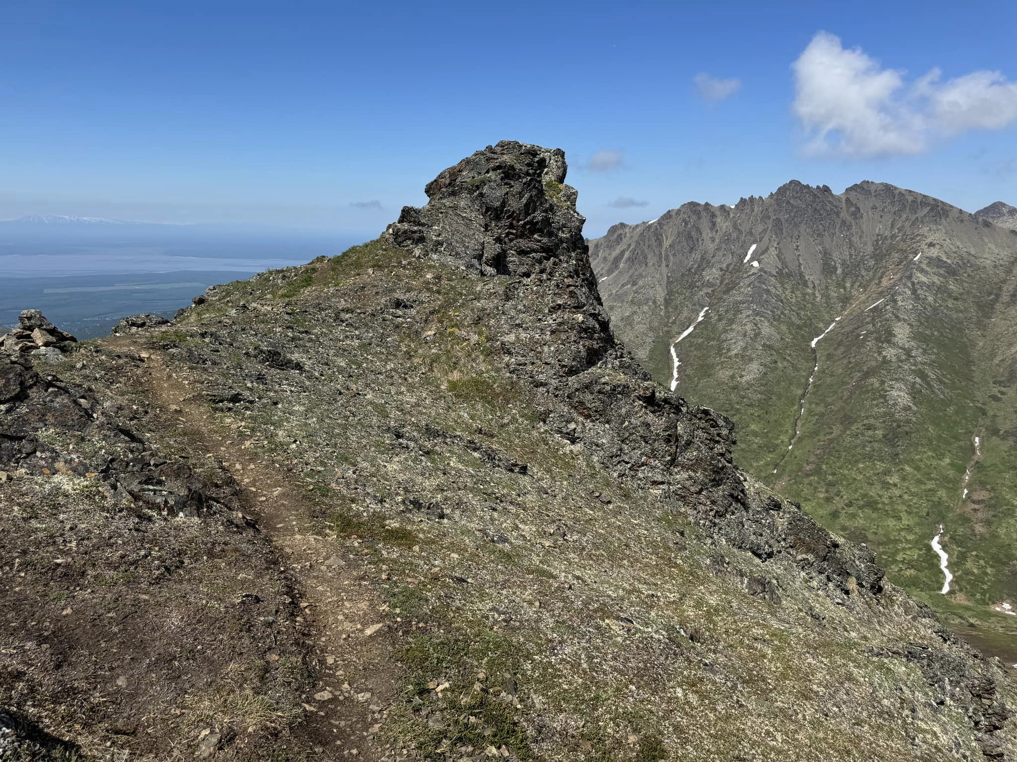
 Today was another sunny perfect day for a nice climb in the mountains. My friends assured me this hike was not as hard as the Government Peak Loop on Saturday. But it was still a very challenging trek. The views of the surrounding mountains and Eagle River below are pretty spectacular. As usual, I started with Bella on her leash in case we encountered other dogs. But after awhile, I let her loose. She ran up and back, hopping over the rocky outcroppings and checking the hiker in front then running back to whoever happened to be bringing up the rear. For a nice change, that wasn't always me. The first part of the trail reminds me of the Blueberry Knoll Trail, very steep and mostly a collection of tree roots that almost form a long steep set of stairs. Once above treeline, we were on a nice ridge. But that ridge seemed to go on forever. It has many ups and downs, which were basically a series of little mountains. I kept wondering which pile of rocks in the far distance would turn out to be Mount Magnificent. We encountered a few patches of snow and did have to cross one. In a few places I broke through and buried my foot about one foot deep. But most of the way I managed to stay on top. Similar to Pepper Peak, we had to negotiate a series of steep rocky precipices that made us all a little nervous at times. There were some small muddy patches and areas where snowmelt was making things more slippery than in the dry season. I had to be careful not to trip over my trekking poles while using both hands to climb up the rocks. I kept worrying about Bella, but it really wasn't necessary. She negotiated the rocks as if she was casually walking on flat ground. She has the balance, energy, and agility of the average squirrel and was at the summit with the two hikers that got there first. It was so nice and warm, around 70 degrees but not as hot as our Saturday hike. We had a nice breeze the whole way up and down. Most of the ridge we had a view of the whole Eagle River Valley. We could see all the mountains of the Chugach Range that surrounded us. There isn't much room on the actual summit, but we managed to have a nice break up there and enjoy a snack. I was concerned that the trip back down might be treacherous since it was a little unnerving on the way up. But Judith and I started down first and easily got through the parts that were scary on the way up, with no trouble at all. Bella of course, bounced easily down all of it. By the time we got about halfway down, Bella was starting to look really tired. She started following right behind me instead of taking the lead all the way down. We both got a nice break when we took a few minutes to rest on some really soft tundra vegetation while the rest of the group caught up with us. Once down into the trees, I started to wonder how I had ever made it up the trail. It seemed so steep and so much longer than I had remembered. I guess we were all very tired. The whole trip was 7 miles and we took about 6 hours. I'm glad I got to do this beautiful hike, and especially since I was with others who had done it before. It was another place where it was difficult to determine exactly where the summit is. There are so many false summits along the way.

Clouds rolling in while we were on the summit


Look closely to see 3 of our group descending from the summit. 

Eagle River down below

Saturday, June 15, 2024

Government Peak Blueberry Knoll Loop

 Government Peak Race Trail is always challenging, whether you are simply hiking it or actually competing on one of several races that occur throughout the year. But today was a little more challenging than usual because it was the hottest day of the year so far. It was only around 75 degrees, which to the rest of the country sounds rather cool. But for Alaskans, and especially on an extremely steep trail in bright sunshine, it was brutal. The summit elevation is 4781 feet and the trail has an elevation of 2900 feet over around 3 miles to the summit. There is nothing technical about the trail but it is consistently very steep most of the way up. I was feeling kind of light-headed by the time I reached the halfway point, but after lots of water and a little food, I felt better. The cool breeze that we encountered the higher we climbed, the better we all felt. I did this hike with a small group of the Valley Wanderers hiking group. I kept Bella on her leash most of the way up because she tends to run up ahead and I was a little concerned that I may want to turn back. But I managed to reach the summit. Bella was also really hot and was delighted when we finally reached some small snow patches. I joined her eating a few handfuls of clean snow. I was the last one to reach the summit but only a little behind a couple of the other ladies. We had a nice break on the top and ate our snacks while enjoying the spectacular 360 degree view of the Talkeetna Mountains. The trip down the same trail is hard on the knees so we all had planned to descend via the more gentle, although longer, trail that leads to Blueberry Knoll. The first half of the descent is along a lovely ridge, with only a small section of rock piles that we needed to carefully negotiate. I let Bella be off her leash all the way down because she does tend to pull and can easily pull me off my feet when negotiating particularly steep and sketchy sections of trail. She happily ran back and forth to whoever happened to be leading, then back to me or whoever was behind me. Perhaps it's a herding instinct of some sort that makes it appear that she wants to make sure we are all together. At times, if I couldn't see her, I'd simply call her name and she would come running back to me. If Bella is on her leash and we encounter another dog, she suddenly turns into the tasmanian devil and tries to attack even dogs 10 times her size. However, when she ran into other dogs, while off her leash, she was all buddy with them and engaged in typical play as if she had known them for years and they were her best friends. I always find that to be very interesting. 

Once off the ridge we entered forest and fairly high brush. Bella sometimes disappeared among the vegetation. Once we joined the Blueberry Knoll Trail it gets kind of tricky because the trail is really just a few miles of tree roots, all doing everything in their power to try to trip hikers. It's still quite steep and in places a little muddy. But I managed to make it the whole way down without any serious tumbles. Although there were a couple of small ones. We took 5 hours to complete the loop. 

View down the ridge we descended


Bella on the summit


Monday, June 10, 2024

Pepper Peak Climb

 I've been wanting to climb this peak for years but never got the chance. Today the Valley Wanderers had a different hike planned but we had to abandon that trail. We had planned to go downhill from the second bench on the Twin Peaks Trail, cross the creek then join he trail to the East Twin. From there, the plan was to climb to the ridge between Twin Peaks and Pepper Peak where you could look out over the whole valley below. But once we reached the creek we had to scrap that plan. The usually small creek was a raging torrent of a river and there was no way for us to cross it. We returned to the second bench then elected to hike up to the overlook on the ridge at the base of Pepper Peak. It was very windy on the ridge. We had a nice break and some snacks and discussed further options. Chris and Erin elected to climb Pepper Peak. They were quickly out of sight because they are very fast. Most of our original group of 14 turned back and descended back to the second bench or straight down the steep trail to the first bench. Virginia wanted to climb Pepper Peak and a few of the group started up the ridge trail. After awhile, our group had dwindled to just Virginia, Madeline and me, plus our two dogs. The ridge was steep but fairly gentle, but the wind was getting stronger. We reached an area of steep rock and loose scree. At that point, Madeline and her dog, Biscuit elected to turn back because she had done the climb before and didn't like the wind. I continued with Virginia. I had heard the trail gets kind of rocky and difficult in places, but I was surprised to see just how rocky it soon became. First we climbed a steep pinnacle, of loose rocks and scree with many places requiring both hands to climb. We had left our trekking poles just before heading up through the rocks because they can really be a hinderance when you need to actually rock climb. I kept Bella on her leash because many of the places were fairly treacherous and I didn't want to lose sight of her or put her in a dangerous situation. Once to the top of the first of these false summit pinnacles, we came to another one just like it. I was starting to wonder if I had made the right choice by continuing, but I managed to keep fairly close to Virginia, following in her footsteps. I can't say that it was really scary, but it was pretty intimidating at times. I didn't like when the rocks I stepped on slid down the mountain beneath me. Each time I thought we had reached the top, we arrived at another huge rocky pinnacle. Each one seemed higher and more treacherous than the last one. Virginia kept saying that we were almost there. Finally once we reached the last one of those, she pointed to a looming tundra and snow covered hill ahead that was the true summit. It looked so far away, but she was right, it wasn't hard to finally reach the top of it. There is a lovely plateau there where we all sat down and had a rest and some food. I had already given Bella all of the dog food that I brought, so I gave her most of the meat, cheese and crackers that I had for myself. I was pretty happy just to gobble down a Snickers bar. I was really worried about how nasty the trip down through all those rocks might be. But to my delight, it really wasn't too bad. I did keep Bella on her leash so she didn't get into trouble and I managed to keep her from pulling me over. Once out of the rocky pinnacles, it was easy sailing back to the overlook and I let the dog run free. We took the very steep trail down to the first bench on the Twin Peaks Trail. I had forgotten just how steep that trail is, and I took a couple of tumbles, but no damage to myself. We were so happy to see that first bench and then walk the nice soft improved trail back down to the parking lot. 8 1/2 miles total. There were wildflowers everywhere and it had become very sunny and beautiful. Even the wind finally stopped. I'm so glad I finally got to climb Pepper Peak. I was quite surprised to find out how difficult it was. I had often thought of going alone, but I doubt I'd have known where or if I had reached the summit. It was very helpful to do this trip with three veteran Pepper Peak climbers. I would not recommend climbing it alone due to the possibility of a slip and fall. But what a spectacular place it is!

Summit Shot

Bella on the summit snowfield


Eklutna Lake from the top


Descending the ridge with Chris, Erin and Virginia

Eklutna Lake from the steep trail to the first bench

Bella and me climbing in the rocks

Friday, June 7, 2024

Matanuska Lake Trails

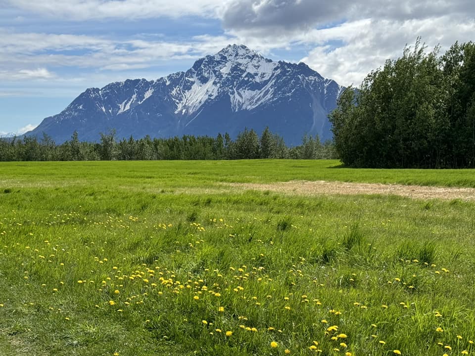
 Most Fridays I do some sort of a hike with my friend Pam. She has been having some back troubles so didn't want to do anything too difficult. We just hiked the Long Lake Loop Trail on the Matanuska Lake Trail system. It's only a little over 4 miles, and is mostly quite gentle. It was really pretty out along the hayfields where the dandelions were blooming. Our dogs certainly enjoyed the little hike. I was tired from tons of yard work myself so it was just the right amount of exercise.


Tuesday, June 4, 2024

Bella's First Kayak Ride

It was a beautiful sunny day and I'm quite hiked out after that steep trek yesterday. I put my folding kayak in my car and went to Reflections Lake with Bella. First we walked the one mile long trail around the lake. Then I got out the kayak and set it up on the shore. Bella was quite happy to hop in and sit on her little doggie cushion while we paddled around the lake, under the bridge and around all the little fingers on the far side of the bridge. We saw lots of birds. Bella liked barking at the seagulls and various shorebirds we saw along the lake. I wondered how she would feel about being out on the water. She seemed quite happy to be there looking around at all the birds and the hikers walking around the lake. Everyone waved at us and seemed to enjoy seeing her there looking like the primary navigator in her pink and orange life vest.  


Monday, June 3, 2024

Gold Star Peak

This was quite an adventure. I love hiking up Gold Star Peak. It's such a special place. It's a couple of peaks dedicated to those who have been lost in wars. Gold Star is the first peak, then you can traverse along a narrow ridge to POW/MIA Peak that is dedicated to the prisoners of war and the missing. There is a very small turnout on the Eklutna Lake Road where people park at mile 4.5. From there, hikers walk another half mile up the road to a steep path straight up the embankment and that is the main trail. That trail is still rather primitive and could certainly stand some improvement, but it is still easy to follow. Chris was leading our Valley Wanderers hike today and showed us an alternative route that started right at the parking spot. I was surprised to see there was any kind of a trail there. It was pretty much straight up but easy to follow for a while. But once out of the trees, the trail disappeared into dried grasses and some brush. We generally just kept heading uphill at that point.We finally found ourselves on a nice open ridge with spectacular views out across the valley and the inlet. There were forget me nots and lupine blooming everywhere. It was pretty easy walking once on the ridge. But we needed to eventually connect with the standard trail to reach the summit. We pondered just continuing up the ridge, but no one was sure what we might encounter before connecting to the trail. So we decided to just head straight to the trail that we could see in the distance. There was a lot of brush and lots of thorns and sticky things. I had let Bella off her leash because she kept going under branches and getting me all tangled up. We got separated at one point and Michelle ended up picking her up because she had entangled herself in a bunch of thorns. I took her and carried her until we were clear of the thorny brush. She had a big stick wound up in her hair across her chest. I was able to carefully pick the hair from it and remove it. We were all delighted when we finally reached the defined trail again. We took a short break at the saddle then started the steepest part of the hike up through the scree and loose rocks and finally reached the monuments on the summit. It's a really tough hike even though it's not terribly log. Our unusual route did make it a bit longer. The total length was over 6 miles. We took another break at the top of Gold Star then walked along the narrow path to POW/MIA. I put Bella back on her leash for that part because she likes to chase squirrels and I had seen several scampering among the rocks. I didn't want her taking after one of them and ending up in a treacherous place. It was getting very windy and it was moving to see the flags blowing in the breeze. It's a wonderful place to ponder the sacrifices that our military heroes have made to give us the freedom that we enjoy. I stopped for a photo with Bella next to the dog silhouette monument to the military dogs of Vietnam. The trip back down was very slippery through the loose scree and rocks, so I had to let Bella find her own way without her leash. She would likely pull me to my death! She is really good about staying with the group and coming immediately when I call her. The trip down seemed to take forever, because we were all so tired. We had one nice glissade down a steep snow slope, that was really fun, after so much difficult walking on the loose rocks and scree. It's a fabulous hike but certainly not an easy one. I think I prefer the main trail, although the ridge walk was very beautiful. 


Saturday, June 1, 2024

Mt Eklutna Climb

 I was hoping I had recovered from my tiredness on Friday. Apparently I got a good night's sleep last night because I felt fine today. I hiked with the Valley Wanderers up Mt Eklutna. Our intention was to do the loop, going first to the top of Mt Eklutna, then following the trail down to the saddle then up along the ridge to Bear Point, and taking that trail back down to the Peter's Creek Trail. But once we got to the saddle on our way up Mt Eklutna, we started running into large snow patches. We got to the top of the first false summit, then we could see that the trail quickly disappeared into deep soft rotten snow. It definitely looked too dangerous to continue. It's a steep slope and it would be easy to start sliding down, even wearing crampons or spikes. A couple of our group didn't even have those. Also, the weather was starting to move in. We found the same situation looking at the trail up towards Bear Point from the saddle. That trail also disappeared into similar dangerous conditions. So we decided to just go back down the way we came. It was a nice hike but a little disappointing because we had to abort our original plan. But it started raining pretty hard by the time we got back to the main trail, so we knew we had made the right decision.